Category:Bossall
village in United Kingdom  | |||||
| Upload media | |||||
| Instance of | |||||
|---|---|---|---|---|---|
| Location | Buttercrambe with Bossall, Ryedale, North Yorkshire, Yorkshire and the Humber, England | ||||
 | |||||
Media in category "Bossall"
The following 43 files are in this category, out of 43 total.
-
 An Avenue From The Wood - geograph.org.uk - 261215.jpg 640 × 480; 105 KB
-
 Ducks on Pond at Bossall - geograph.org.uk - 723735.jpg 1,744 × 1,308; 2.43 MB
-
 Entering Bossall - geograph.org.uk - 2012278.jpg 640 × 480; 116 KB
-
 Entering Bossall, North Yorkshire - geograph.org.uk - 2325932.jpg 800 × 600; 303 KB
-
 Estate Lodge at Bossal - geograph.org.uk - 1227284.jpg 640 × 438; 87 KB
-
 Farm Outbuildings at Barnby House - geograph.org.uk - 5493285.jpg 5,184 × 3,456; 6 MB
-
 Ponds and Land Drain - geograph.org.uk - 261938.jpg 640 × 480; 105 KB
-
 Rape coming into flower - geograph.org.uk - 778854.jpg 640 × 478; 272 KB
-

-
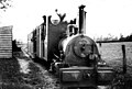 Sand Hutton Light Railway - Bossall station.jpg 585 × 397; 40 KB
-
 Towards Belle View Farm - geograph.org.uk - 778849.jpg 640 × 478; 242 KB
-
 Track towards the Derwent - geograph.org.uk - 778868.jpg 640 × 478; 215 KB
-
 Woodhouse Farm - geograph.org.uk - 350107.jpg 640 × 480; 157 KB
-
 A Field And Bossall Wood - geograph.org.uk - 261221.jpg 640 × 480; 101 KB
-
 A View Of Aldby Park - geograph.org.uk - 261226.jpg 640 × 480; 98 KB
-
 Bales at Mount Pleasant Farm - geograph.org.uk - 778844.jpg 640 × 478; 264 KB
-
 Between Bossall and Howsham - geograph.org.uk - 189374.jpg 640 × 479; 52 KB
-
 Bossall Lodge - geograph.org.uk - 778821.jpg 478 × 640; 313 KB
-
 Bossall to Harton road - geograph.org.uk - 1435385.jpg 640 × 480; 75 KB
-
 Brough Plantation - geograph.org.uk - 1435411.jpg 640 × 480; 105 KB
-
 Carr Field - geograph.org.uk - 189376.jpg 640 × 479; 45 KB
-
 Ecological Water Treatment - geograph.org.uk - 389760.jpg 640 × 480; 84 KB
-

-
 Farmland near Mount Pleasant Farm - geograph.org.uk - 778837.jpg 640 × 478; 251 KB
-
 Field outside Bossall - geograph.org.uk - 189372.jpg 640 × 479; 49 KB
-
 Horses - Bossall - geograph.org.uk - 189348.jpg 640 × 479; 46 KB
-
 Howsham Bridge - geograph.org.uk - 24730.jpg 640 × 480; 208 KB
-
 Junction - geograph.org.uk - 522071.jpg 640 × 480; 123 KB
-
 Mill Crofts - geograph.org.uk - 189377.jpg 640 × 479; 115 KB
-
 Pump by the River Derwent - geograph.org.uk - 540776.jpg 640 × 480; 101 KB
-
 Rectory Farm - geograph.org.uk - 261064.jpg 640 × 480; 72 KB
-

-
 Riverside footpath - geograph.org.uk - 540778.jpg 640 × 480; 101 KB
-
 Scaryingham Old School - geograph.org.uk - 352023.jpg 640 × 435; 64 KB
-
 Stubble - geograph.org.uk - 266027.jpg 640 × 480; 95 KB
-
 The River Derwent south of Paradise Farm - geograph.org.uk - 540771.jpg 640 × 480; 117 KB
-
 The Road From Buttercrambe to Bossall - geograph.org.uk - 259445.jpg 640 × 480; 106 KB
-
 The Road From Harton - geograph.org.uk - 260908.jpg 640 × 480; 102 KB
-
 The Road Past Aldby Park - geograph.org.uk - 261230.jpg 640 × 480; 102 KB
-
 The Road Through Bossall Wood - geograph.org.uk - 261212.jpg 640 × 480; 99 KB
-
 The Road To Bossall - geograph.org.uk - 259448.jpg 640 × 480; 104 KB
-
 The Road To Harton - geograph.org.uk - 266029.jpg 640 × 480; 98 KB
-
 Woodhouse Farm - geograph.org.uk - 261222.jpg 640 × 480; 106 KB


