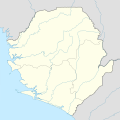
Payl:Sierra Leone location map.svg
Appearance

Size of this PNG preview of this SVG file: 600 x 600 ka mga piksel. Uban pang mga resoluyon: 240 x 240 ka mga piksel | 480 x 480 ka mga piksel | 768 x 768 ka mga piksel | 1,024 x 1,024 ka mga piksel | 2,048 x 2,048 ka mga piksel | 1,607 x 1,607 ka mga piksel.
Tibuok resolusyon (SVG nga payl, nominally 1,607 × 1,607 pixels, size sa payl: 244 KB)
Kaagi sa payl
I-klik ang petsa/oras aron makit-an ang hulagway sa payl niadtong panahona.
| Petsa/Takna | Thumbnail | Mga dimensyon | Tiggamit | Komento | |
|---|---|---|---|---|---|
| kasamtangan | 19:39, 10 Disyembre 2008 |  | 1,607 × 1,607 (244 KB) | NordNordWest | {{Information |Description= {{de|Positionskarte von Sierra Leone}} Quadratische Plattkarte. Geographische Begrenzung der Karte: * N: 10.2° N * S: 6.8° N * W: 13.5° W * O: 10.1° W {{en|Location map of [[:en:Sierra Leone|Sierra Leon |
Mga paggamit sa payl
More than 100 pages use this file. The following list shows the first 100 pages that use this file only. A full list is available.
- Baba
- Banga
- Bange
- Bangi
- Bende
- Bengo
- Bird Island
- Birimba
- Bondo
- Boto
- Bumbe
- Congo
- Congo River
- Dama (pagklaro)
- Danga
- Debia
- Dembe
- Dumbo (pagklaro)
- Fata
- Freetown
- Fula
- Kabala
- Kaka (pagklaro)
- Kala
- Kale
- Kaloko
- Kamara
- Kambo
- Kariba
- Karimba
- Kaseke
- Keru
- Kinda
- Kindi
- Kirimbi
- Kolowa
- Konkoro
- Kori
- Kose
- Koya
- Kumba (pagklaro)
- Lala
- Leye
- Lolo (pagklaro)
- Loma
- Lomba
- Long Island
- Longbo
- Lumbe
- Lunga
- Mabala
- Mabo
- Magwe
- Makara
- Malanga
- Malondo
- Mama (pagklaro)
- Mambo
- Mamboma
- Mana (pagklaro)
- Mandiri
- Manga (pagklaro)
- Mapo
- Maria (pagklaro)
- Matange
- Mataro
- Matete
- Matoko
- Middle Ground
- Mola (pagklaro)
- Mongo
- Ngolo
- Pambe
- Pata (pagklaro)
- Pole
- Porta (pagklaro)
- Saint George
- Sambwe
- Sanda
- Sanga
- Sela
- Seli
- Sende
- Sendi
- Senge
- Simba
- Sugar Loaf
- Sunga
- Tabe
- Tama (pagklaro)
- Tamba (pagklaro)
- Tambi
- The Sisters
- Toba (pagklaro)
- Toli
- Tomba
- Tongo
- Wawa
- West Bay
- Wolf Rock
View more links to this file.
Global nga paggamit sa payl
Kining ubang wiki naggamit ning maong payl:
- Paggamit sa af.wikipedia.org
- Paggamit sa am.wikipedia.org
- Paggamit sa an.wikipedia.org
- Paggamit sa ar.wikipedia.org
- Paggamit sa az.wikipedia.org
- Paggamit sa be-tarask.wikipedia.org
- Paggamit sa be.wikipedia.org
- Paggamit sa bg.wikipedia.org
- Paggamit sa bn.wikipedia.org
- Paggamit sa bs.wikipedia.org
- Paggamit sa ce.wikipedia.org
- Paggamit sa ckb.wikipedia.org
- Paggamit sa cs.wikipedia.org
- Paggamit sa da.wikipedia.org
- Paggamit sa de.wikipedia.org
- Paggamit sa de.wikivoyage.org
- Paggamit sa el.wikipedia.org
- Paggamit sa en.wikipedia.org
- Paggamit sa es.wikipedia.org
View more global usage of this file.


