The nation of Malaysia is in two parts: Peninsular Malaysia (also called West Malaysia or Malaya) on the southern end of the Malay Peninsula and Malaysian Borneo (East Malaysia) on the island of Borneo roughly 700 km (450 mi) to the east. East Malaysia includes two former British colonies, Sarawak and Sabah, plus a smaller territory called Labuan. Another former British protectorate in Borneo, Brunei, is an independent enclave surrounded by East Malaysia. Sarawak was ruled from 1842 to 1946 by Sir James Brooke and his descendents, who were known as the "White Rajahs," while Sabah was controlled by the British North Borneo Company from 1881 to 1946. Redesignated as crown colonies in 1946, both regions were incorporated states of the independent Malaysia in 1963.
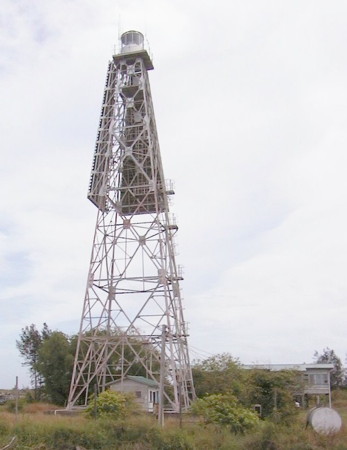
Malaysia is a federal constitutional monarchy consisting of thirteen states and three federal territories. Sarawak is the largest of the states. The coast of Sarawak faces northwest on the South China Sea. Many of its lighthouses are in remote areas, so they attract few visitors. For administration Sarawak is divided into twelve divisions.
In March 2022 the Transport Ministry of Sarawak announced plans to restore and upgrade seven lighthouses: Tanjung Dato, Tanjung Po, Tanjung Jerijeh, Tanjung Sirik, Tanjung Kidurong, Tanjung Lobang and Tanjung Baram.
Malay is the official language of Malaysia; English is also a "recognized" language. The Malay term for a lighthouse is rumah api ("house of fire"); pulau is an island, terumbu is a reef, tanjung is a cape, bukit is a hill, sungai is a river, kuala is the mouth of a river, teluk is a bay, selat is a strait, and pelabuhan is a harbor.
Aids to navigation in Malaysia are the responsibility of the Marine Department (Jabatan Laut), an agency of the Ministry of Transport. Sarawak and Sabah formerly had independent marine departments, but they were merged with the Peninsular Malaya marine department in 2011.
Special thanks to Ezmil Sahrani of GreenFinder Asia for permission to post several of his photos on this page.
ARLHS numbers are from the ARLHS World List of Lights. MY numbers are Malaysian light list numbers, where known. Admiralty numbers are from volume F of the Admiralty List of Lights & Fog Signals. U.S. NGA List numbers are from Publication 112.
- General Sources
- Lighthouses of Malaysia
- Photos posted by Greenfinder.asia, a navigational aids and maritime services company. Most if not all of these photos are by Ezmil Sahrani.
- Online List of Lights - Sarawak
- Photos by various photographers posted by Alexander Trabas.
- Lighthouses in Malaysia
- Photos by various photographers available from Wikimedia.
- Malaysian Lighthouses
- Historic postcard views posted by Michel Forand.
- GPSNavigationCharts
- Navigational chart information for East Malaysia.
- Navionics Charts
- Navigational chart for East Malaysia.


